Drone Roof Inspection vs. Satellite Measurement: Which Is Best in 2026?
Reviewed by roofing measurement engineers · References NBC 2020, IRC 2021, FBC 8th Ed. · Roof Manager is the roof measurement & CRM platform trusted by 5,000+ contractors across the US & Canada · Editorial policy.
TL;DR
Drones hit 99.9% DIN-compliant accuracy but cost $200+/roof and need FAA licensing. Satellites deliver 97%+ accuracy in 1–2 hours for under $15. Here's when to use each — and why most operations use both.
Quick Answer: Satellite measurement wins on speed and cost (1–2 hour reports for $8–$15 at 97–99% accuracy) and is the right choice for initial quoting, lead qualification, and standard residential work. Drones win on damage-granularity and complex geometry (99.9% DIN-compliant accuracy, thermal leak detection, close-range documentation) but cost $150–$500 per roof and require FAA Part 107 licensing in the U.S. or Transport Canada compliance in Canada. Most high-performing roofing operations in 2026 use both — satellite for the quote, drone for insurance documentation on signed jobs.
Roofing contractors in 2026 have three choices for aerial measurement, and the industry's loudest voices keep framing it as a fight. Drone companies argue drones are the future; satellite providers argue satellite is faster and cheaper; and a handful of trade publications pretend manual tape measurement is still viable for anything other than very small accessible roofs.
The reality is more useful. Each technology has a specific job it does better than the others. A roofing operation that picks only one is either spending too much on simple jobs or losing precision on complex ones. This post breaks down what each technology actually delivers, where each one fails, and how to build a hybrid workflow that uses both at the right moments.
The End of Handheld Measurement: Enhancing Safety and Speed
Before the comparison gets technical, it's worth naming what we're all leaving behind: climbing the roof with a tape measure. Handheld measurement still happens — most often on small, accessible roofs or during a final pre-installation walk — but as the primary measurement method for quoting and insurance work, it has become indefensible on three grounds.
Safety. Falls from roofs remain the single largest category of fatal injury in the construction industry. OSHA data through 2024 shows roofing as the highest-fatality-rate specialty contracting trade. Every ladder climb for a measurement-only purpose is an avoidable exposure.
Accuracy. Handheld tape measurement on a complex residential roof lands at ±3–5% in the best case, and much worse on cut-up geometries with hips, valleys, and dormers that can't be cleanly measured in straight pulls. Both drone and satellite methodologies improve on that baseline by a factor of two to five.
Speed. A careful manual measurement of a 30-square residential roof takes 30–90 minutes including pitch gauging and sketching. Satellite measurement takes 1–2 hours. Drone measurement takes 15–30 minutes including the flight. Any time saved is time the crew can redeploy to revenue work.
With tape measurement out of the picture for primary quoting, the real debate is between satellite and drone — and the two are genuinely different products serving different phases of the contracting workflow.
Satellite Measurement: Instant Quoting and Lead Qualification
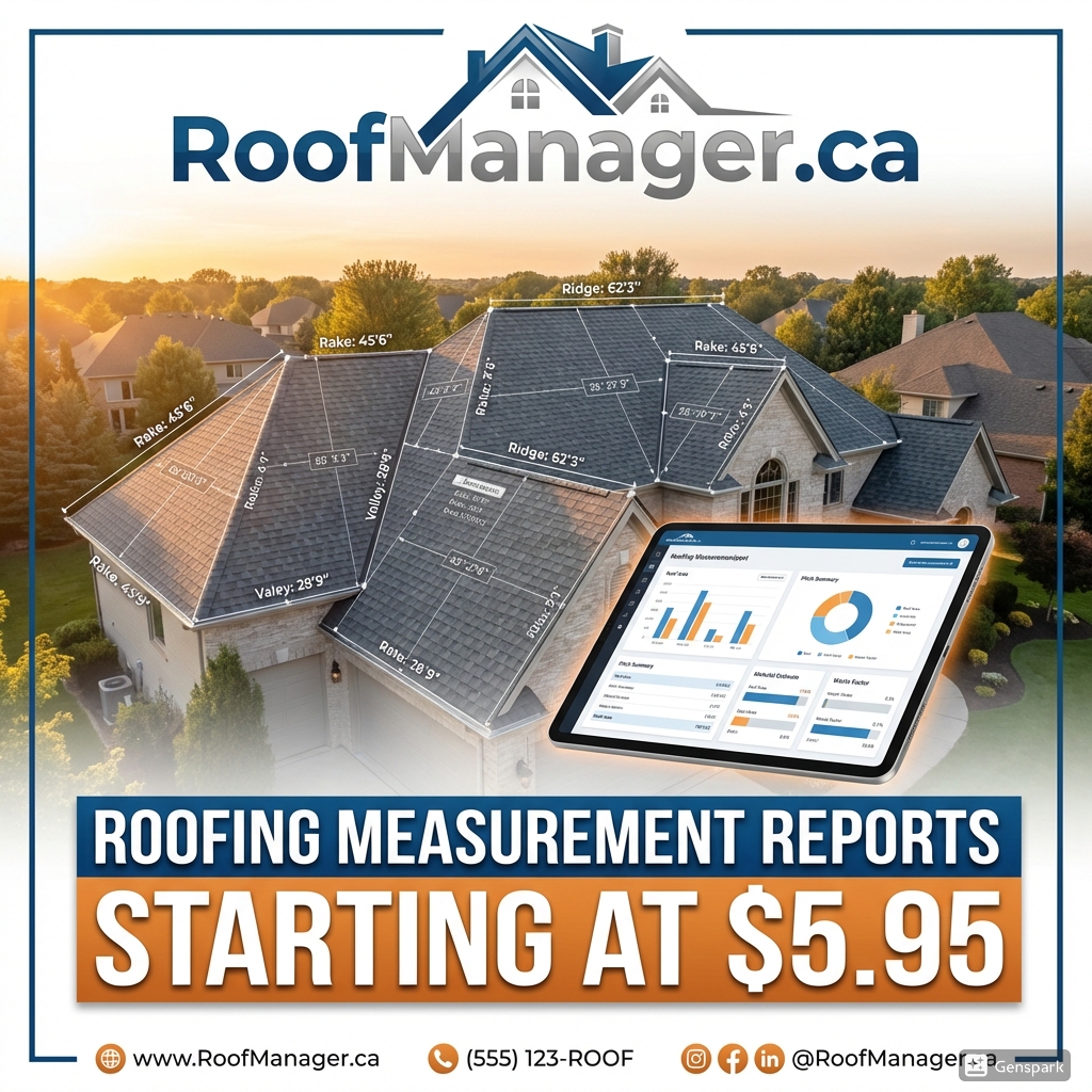
Satellite-based roof measurement combines high-resolution aerial imagery (10–25 cm per pixel in most of the developed world) with elevation data derived from LiDAR, stereo photogrammetry, or Digital Surface Models. A measurement platform traces the roof's facets, applies automated or user-confirmed pitch, and returns projected area, slope-adjusted area, linear edges, and material takeoff — typically in 1–2 hours.
Accuracy in 2026. Independent benchmarking, including our 20-roof accuracy test against a traditional aerial report provider, places modern satellite-derived measurements within 1–2% of drone ground truth on residential roofs in high-imagery-quality regions. Pitch accuracy is typically within 0.5–1.0 degrees. That's accurate enough for material orders, insurance-accepted estimates, and binding contractor quotes on standard work.
Where satellite wins.
- Initial quoting and lead qualification. Speed compounds.
- Standard residential gables, hips, and hip-gable combinations.
- Large-volume workflows (storm deployments, dealer networks) where per-roof cost dominates.
- Remote quoting during the customer's first phone call — when the customer is still on the line, a 1–2 hour report beats any alternative.
- Pre-site-visit planning, so crews arrive with a measurement already in hand.
Where satellite falls short.
- Recent construction or renovations not yet captured in imagery. imageryDate can lag by 6–36 months.
- Dense tree canopy obscuring roof edges.
- Very complex commercial roofs with many penetrations, parapets, and mechanical equipment.
- Active damage documentation — you can see that shingles are present, not that they're cracked or lifted.
- Close-range inspection of flashing, ridge cap condition, or granule loss.
Typical cost and turnaround. $8–$15 per report for AI-native platforms like RoofManager; $25–$50 for traditional aerial report providers. Turnaround ranges from 30–90 seconds (AI-native) to 1–48 hours (legacy providers that still route through human QA).
Drone Inspections: High-Fidelity LiDAR and Damage Detection
Drone measurement uses a multi-rotor or fixed-wing unmanned aircraft to capture overlapping high-resolution photos, sometimes supplemented with LiDAR or thermal sensors. Photogrammetry software (Pix4D, DroneDeploy, SkyeBrowse) stitches the images into a 3D model from which measurements and orthomosaic imagery are derived.
Accuracy in 2026. Drones with RTK (Real-Time Kinematic) GPS correction deliver horizontal accuracy of ±2 cm in optimal conditions. Industry reporting places drone-derived roof measurement at 99.9% DIN-compliant accuracy on complex geometries — the tightest tolerance available short of a terrestrial survey. LiDAR-equipped drones can penetrate partial tree canopy and generate centimeter-grade point clouds that resolve individual shingle rows.
Where drones win.
- Complex geometries — mansards, multi-dormer Victorians, architectural roofs with heavy detail.
- Damage documentation for insurance claims, particularly hail bruising, wind lift, and impact patterns that require close-range photographic evidence.
- Thermal imaging for active leak detection through roof membrane moisture signatures.
- Very steep roofs where satellite pitch estimation struggles.
- Commercial roofs with penetration counts, drainage analysis, and membrane condition assessment.
- Pre-contract final verification after satellite-based quoting — confirming the satellite measurement before committing to material orders on high-ticket jobs.
Where drones fall short.
- Cost. $150–$500 per roof in operator time, equipment amortization, and travel, compared to $8–$15 for satellite.
- Time. Even a quick drone flight takes 15–30 minutes plus travel to site. Scheduling and weather delays routinely push turnaround to days.
- Licensing. FAA Part 107 is required for any commercial drone operation in the U.S.; Transport Canada requires a Basic or Advanced Operations certificate in Canada. Training, testing, currency maintenance, and liability insurance compound the cost.
- Flight restrictions. No-fly zones around airports, heritage districts, military installations, and some residential areas block drone deployment entirely.
- Weather. Rain, high winds (typically >15 mph), and low visibility ground drone operations on a meaningful percentage of days.
- Operator availability. A roofing operation needs either an in-house pilot or a third-party drone service — both scale linearly with volume in a way that satellite does not.
Comparative Analysis: Accuracy, Cost, and Turnaround Time
The head-to-head on the three metrics that matter:
| Metric | Handheld tape | Satellite (AI-native) | Drone (RTK) |
|---|---|---|---|
| Area accuracy | ±3–5% | ±1–2% | ±0.2% |
| Pitch accuracy | ±1–2° | ±0.5–1.0° | ±0.1° |
| Turnaround time | 30–90 min (onsite) | 30–90 seconds | 15–30 min flight + processing |
| Cost per roof | Labor + risk | $8–$15 | $150–$500 |
| Licensing required | None | None | FAA Part 107 / Transport Canada |
| Weather sensitivity | Moderate | None (imagery is pre-captured) | High |
| Damage documentation | Limited | Limited | Excellent |
| Thermal / leak detection | No | No | Yes (thermal-equipped drones) |
| Works on complex commercial | Poor | Moderate | Excellent |
| Scales to 100+ roofs/week | No | Yes | Only with fleet of pilots |
| Customer impact (site visit) | Required | None | Required |
The table makes the tradeoff obvious. Satellite is not competing with drone on precision — it's competing on the entire rest of the column. Drone is not competing with satellite on cost or speed — it's competing on damage granularity and complex-geometry performance.
Building a Hybrid Workflow: When to Use Which Tool
The content almost all competing articles miss is that these are not mutually exclusive technologies. A well-run 2026 roofing operation uses both, deployed at different points in the funnel:
Stage 1 — Lead qualification and quoting (satellite). The moment a lead enters the CRM — whether via AI receptionist, web form, or direct call — an automated satellite measurement runs against the property address. The sales rep has slope-adjusted area, pitch, and a priced quote within 1–2 hours. This is the stage where first-responder speed wins the job 85% of the time; no drone workflow can match it.
Stage 2 — Signed contract verification (drone, conditional). On signed jobs above a threshold value (typically $15,000) or with complex geometry, a drone flight is scheduled within 48 hours of the contract signing. The drone pass confirms the satellite measurement, captures close-range imagery for the project record, and generates detailed condition documentation. Any material-takeoff corrections happen here before the first shingle is ordered.
Stage 3 — Insurance documentation (drone, mandatory on claims). For storm-restoration and insurance claim work, a drone flight with thermal imaging is mandatory at the inspection stage. The drone's granular damage imagery is what the adjuster sees; satellite won't cut it for an insurance approval packet. On very high-ticket or disputed claims, a follow-up drone pass during the tear-off stage provides condition documentation that prevents warranty and scope disputes.
Stage 4 — Post-installation verification (drone, optional). For high-value jobs or operations with strong QA programs, a final drone pass after installation documents workmanship and creates a before/after pair for marketing and warranty purposes.
The economics work out cleanly. On a typical small-to-mid residential operation:
| Workflow | Cost per roof | When to use |
|---|---|---|
| Satellite only | $8–$15 | Standard residential, quoting phase |
| Satellite + drone verification | $180–$500 | Signed jobs >$15K, complex geometry |
| Satellite + drone + thermal | $300–$700 | Insurance claims, storm restoration |
The satellite cost is negligible against every stage. The drone cost is only incurred when the drone's specific capabilities (granularity, thermal, insurance documentation) are actually required.
Regulatory and Safety Notes Worth Knowing
Two regulatory realities that trip up operations new to drone work:
U.S. — FAA Part 107. Any commercial drone operation (even a single roof inspection for a paying client) requires the operator to hold a Part 107 Remote Pilot Certificate. This is a written test and a recurring currency requirement. Operating without a license exposes the operation to FAA fines and, more importantly, voids liability insurance on any incident. Roofing operations using third-party drone services should verify Part 107 currency before contracting.
Canada — Transport Canada CARs Part IX. Commercial drone operations require a Basic or Advanced Operations Pilot Certificate depending on flight conditions. Advanced certification is required for any operation in controlled airspace, near bystanders, or within 30m of people. Fines for non-compliance mirror the U.S. regime.
Airspace restrictions. Both countries maintain overlapping restricted airspace around airports, military bases, national parks, and certain urban areas. Tools like B4UFLY (U.S.) and NAV Drone (Canada) are essential pre-flight checks. Roofs within 5 miles of a controlled airport routinely require LAANC authorization that can take hours to approve, which makes same-day drone dispatch impossible in many metro areas.
Privacy. Drone operations over residential property require implied or explicit consent. Most operations handle this via standard contract language during customer onboarding.
Which Platform Is Best for Roofing Contractors in 2026?
The honest answer is that the right stack for most operations is:
- Primary tool: AI-native satellite measurement for all quoting, standard residential work, and lead qualification. $8–$15 per report, 1–2 hour turnaround, native CRM integration.
- Secondary tool: drone operations either in-house (if volume justifies a licensed pilot on payroll) or via a contracted drone service (if volume is variable). Deployed on signed jobs above the threshold value and on all insurance claim work.
Operations that skip satellite and go drone-only pay too much per quote and lose early-funnel leads to faster competitors. Operations that skip drone and go satellite-only win the quoting phase but give up damage-documentation precision on insurance work — which matters enormously in storm-restoration markets where carriers are increasingly demanding granular evidence.
For the full accuracy comparison between AI-native satellite measurement and legacy providers, our 20-roof legacy-provider benchmark has the per-roof Δ% data. For how this fits into the 48-hour post-storm execution pattern, see the Storm Restoration Playbook.
Frequently Asked Questions
Are drone roof measurements better than satellite?
Drones are more accurate (±0.2% area vs. ±1–2%) and much better for damage documentation and thermal leak detection. Satellite is dramatically faster (1–2 hours vs. 15–30 minutes plus travel) and cheaper ($8–$15 vs. $150–$500). Neither is universally better — they serve different stages of the roofing workflow.
How accurate are satellite roof measurement reports?
Modern satellite-based roof measurement in high-imagery-quality regions delivers area within 1–2% of drone ground truth and pitch within 0.5–1.0 degrees. Accuracy degrades in areas with heavy tree cover, recent construction not yet captured in imagery, or very complex commercial geometries.
Do I need an FAA license to fly a drone for roofing?
Yes. Any commercial drone operation in the U.S. requires the operator to hold an FAA Part 107 Remote Pilot Certificate. This applies even to a single roof inspection for a paying customer. Canada requires a Transport Canada Basic or Advanced Operations Pilot Certificate under the CARs Part IX framework.
What is the tolerance of drone vs satellite measurements?
RTK-equipped drones deliver ±2 cm horizontal accuracy, translating to 99.9% DIN-compliant roof measurement tolerance. AI-native satellite measurements typically achieve 98–99% tolerance on residential roofs in high-imagery-quality regions. Both exceed the tolerance required for insurance claims and material ordering.
How much does a drone roof inspection cost?
A single drone roof inspection typically runs $150–$500, depending on roof complexity, operator experience, and whether thermal imaging is included. In-house operations amortize equipment and licensing costs across volume; third-party drone services charge on a per-roof basis with volume discounts available at 20+ inspections per month.
Can satellites measure steep pitch roofs accurately?
Yes, for pitches up to roughly 12/12 (45°). Steeper pitches — unusual in residential construction but common on Victorian, Tudor, and some European styles — can introduce pitch estimation errors because of reduced visibility of the facet's vertical extent in straight-overhead imagery. For roofs steeper than 12/12 or for architectural styles with unusual geometry, drone verification is recommended.
What is roof inspection software and how does it work?
Roof inspection software captures drone imagery, stitches overlapping photos into a 3D photogrammetric model, and produces measurement reports and damage documentation. Leading platforms include DroneDeploy, SkyeBrowse, Pix4D, and RoofMeasurements by Loveland Innovations. Most integrate with roofing CRMs to attach imagery and measurements to job records.
Which platform is best for roofing contractors in 2026?
The highest-performing operations use a hybrid stack: AI-native satellite measurement (RoofManager and comparable AI-native platforms) as the primary tool for quoting and standard residential work, supplemented by drone operations (in-house or contracted) for signed jobs over $15,000 and for all insurance claim documentation.
RoofManager's satellite measurement platform delivers insurance-ready reports in 1–2 hours at $8 per report and integrates with all major drone inspection platforms for the hybrid workflow described above. Start a free trial or request a technical demo to see the combined workflow in action.